
While there is still some uncertainty regarding the weather forecast for the Central Appalachian region, there are some general ideas that seem to be emerging in the model guidance.
Here is a breakdown of what we are expecting at this point:
- A seasonably cool, but generally quiet start to the week
- A milder, but more unsettled period leading up to Thanksgiving
- The potential for a much colder and wintry pattern to take shape in the days following Thanksgiving
What Is The Pre-Thanksgiving Weather Forecast?
The beginning of Thanksgiving week is likely to favor seasonably cool, but dry weather conditions over the Central Appalachians. As we head into the day on Tuesday, a weather system will likely move northeast from the Southern Plains toward the Great Lakes.This system will likely bring the chance for rain to the forecast as we head toward mid-week.
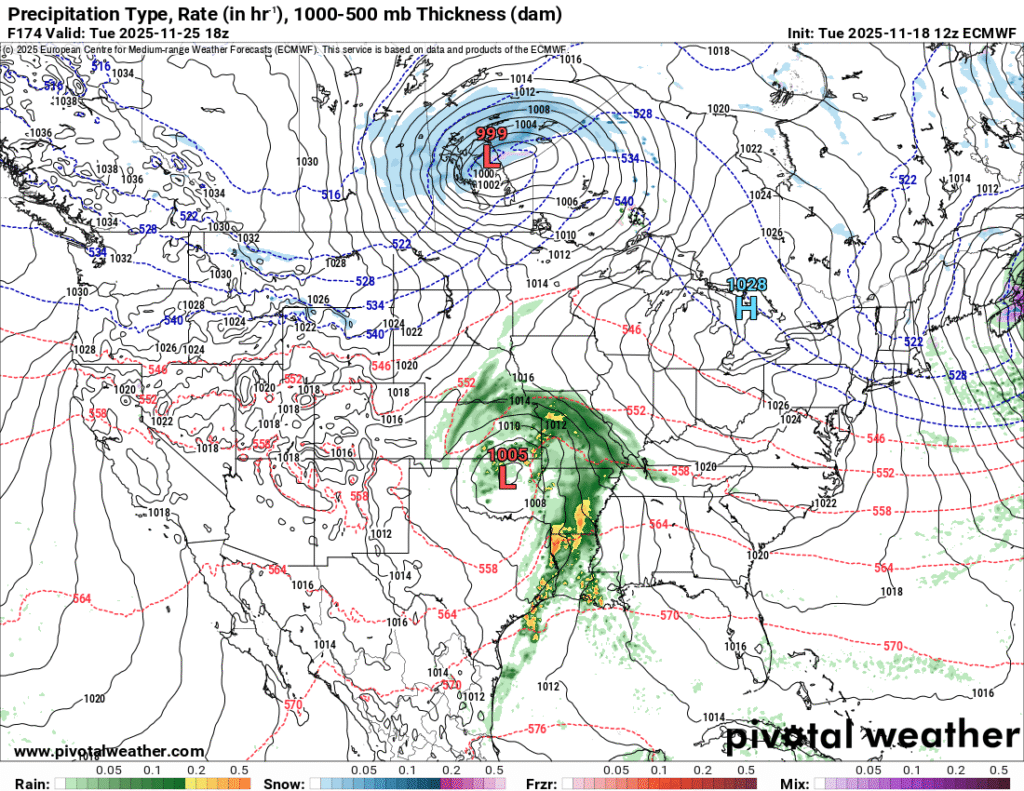
The model image above shows the approach of a weather system at mid-week that will follow a relatively calm start to the week. Image courtesy of Pivotal Weather.
What Should You Expect For Your Thanksgiving Day Forecast?
As we head out to our family gatherings to eat turkey and watch football, the pattern across the Central Appalachian region will likely turn stormy as an amplified polar jet begins to dive toward the central and Eastern United States. Some uncertainty exists regarding the timing of a cold front that will usher in much colder air. As it stands right now, Thanksgiving day may be a transitional weather day with unsettled weather conditions. At this point, it appears the system will mostly bring precipitation in the form of rain for most areas, but this is subject to change. In addition, there could also be a wind component as well.
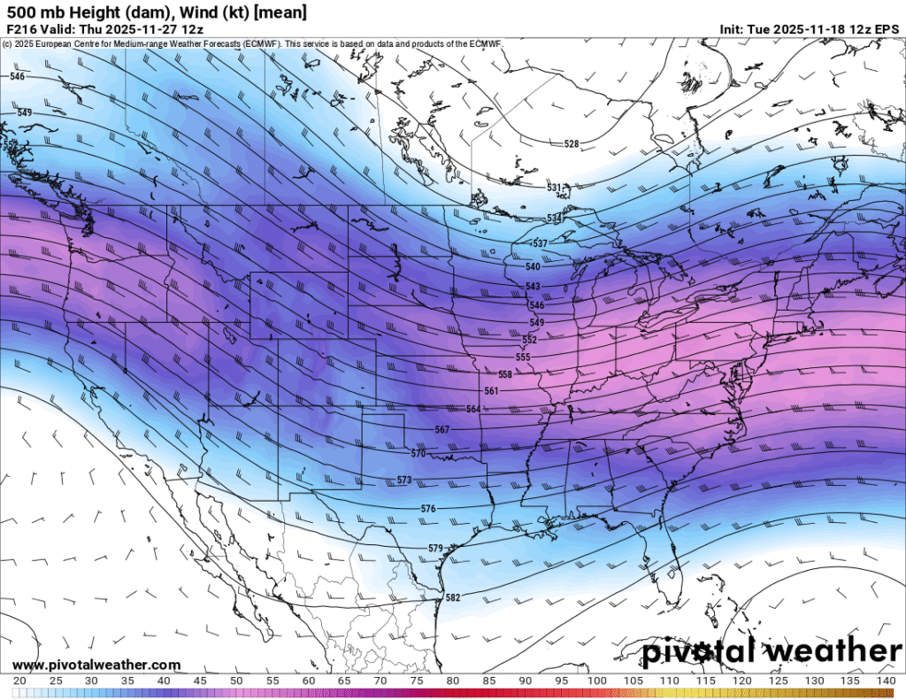
This image shows a dip in the jet stream that is projected to move through the Central U.S. around Thanksgiving. Image courtesy of Pivotal Weather.
Is It Going To Snow After Thanksgiving?
While this time period is over a week away, there are indications that the weather pattern will turn much colder. There is also the potential for some winter weather as well.
One of the primary ways that forecasters get insights for long range forecasting involves Teleconnections. Some of the more common teleconnections that forecasters use to forecast long range weather patterns include:
- North Atlantic Oscillation (NAO)
- Arctic Oscillation (AO)
- Pacific-North American Index (PNA)
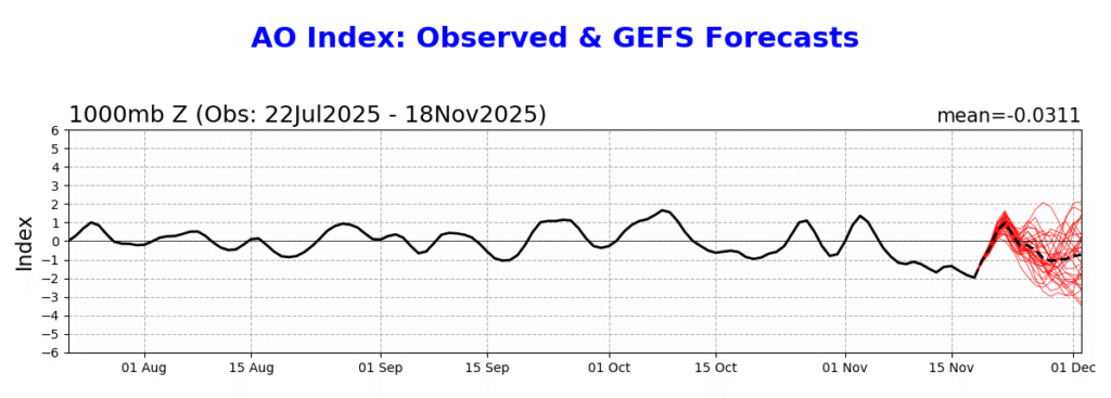
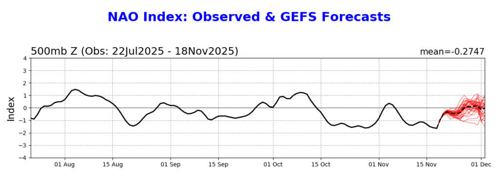
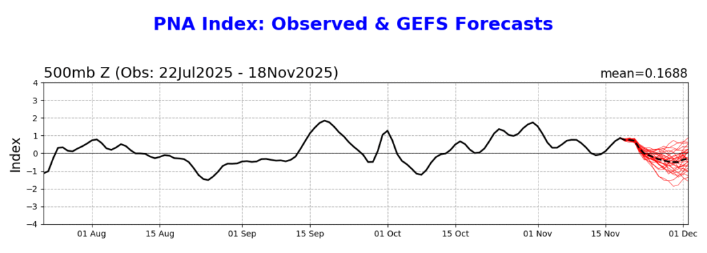
The images above show the history and forecast of the AO, NAO, and PNA. Images courtesy of the Climate Prediction Center.
A negative phase of the NAO tends to lead to colder and unsettled conditions in the Eastern U.S. While a negative AO does not directly correlate to a colder pattern in the Eastern U.S., it does tend to offer more opportunities for cold air to sink southward. In contrast to the NAO, the negative phase of the PNA tends to favor colder conditions in the western United States.
Bottom Line
The forecast is still about a week out, and there will need to be modifications to the forecast as we get closer to the Thanksgiving holiday.
Here is a quick recap of the Thanksgiving week weather forecast:
- The week will likely start on a seasonably cool, but dry note.
- There will likely be a couple days of mild, but unsettled weather as we approach Thanksgiving Day
- Black Friday and the weekend following Thanksgiving will likely turn colder with the potential for some winter weather impacts.
Be sure to check back for updated information as the forecast models begin to diverge on a forecast solution.
Leave a Reply