

Latest Blog Posts
- CAWA Weekly Meteorology Brief — October 5, 2026The week at a glance Central Appalachia is heading into a quieter stretch of weather. A cold front will bring cooler air and a gusty breeze Monday, followed by the week’s main concern: frost Monday night into Tuesday morning. The best chance of frost will be across northern Pennsylvania, the mountains of northern West Virginia… Read more: CAWA Weekly Meteorology Brief — October 5, 2026
- CAWA Weekly Meteorology Brief — September 27, 2026The week at a glance This should be a fairly quiet week across Central Appalachia. Clouds left behind by the departing coastal storm may linger Monday, particularly across western Pennsylvania and the mountains. Patchy valley fog is also possible during the first few mornings of the week. Tuesday through Thursday should be dry and increasingly… Read more: CAWA Weekly Meteorology Brief — September 27, 2026
- CAWA Weekly Meteorology Brief — September 20, 2026The week at a glance Keep the rain gear handy. Several weather systems will cross Central Appalachia through the middle of the week, bringing repeated rain and a few thunderstorms. The greatest immediate concern is flooding Monday. Official Flood Watches cover much of southeastern Ohio, northern and central West Virginia, southwestern Pennsylvania and areas near… Read more: CAWA Weekly Meteorology Brief — September 20, 2026
- CAWA Weekly Meteorology Brief — September 13, 2026The week at a glance Monday will feel noticeably cooler and less humid across Central Appalachia. That break will not last long: temperatures and humidity climb Tuesday, with hot conditions returning to West Virginia by Wednesday. Thunderstorms may begin near Lake Erie and northeastern Ohio Tuesday night. Scattered storms remain possible Wednesday and Thursday as… Read more: CAWA Weekly Meteorology Brief — September 13, 2026
- CAWA Weekly Meteorology Brief – September 6, 2026The week at a glance Most of Central Appalachia gets a pleasant Labor Day before heat and humidity return. Wednesday will be the hottest day, with afternoon temperatures reaching the upper 80s and lower 90s in many valleys and lower elevations. A cold front will bring thunderstorms into eastern Ohio and western Pennsylvania Wednesday evening… Read more: CAWA Weekly Meteorology Brief – September 6, 2026
- CAWA Weekly Meteorology Brief – August 31, 2026Summary: Heat and humidity will take over much of Central Appalachia this week. Wednesday should be the hottest day around western Pennsylvania and eastern Ohio, while dangerous heat may last into Thursday across parts of West Virginia and western Maryland. There will also be several chances for thunderstorms. Instead of one clearly defined system, multiple… Read more: CAWA Weekly Meteorology Brief – August 31, 2026
- What Is El Nino, And How Does It Affect Our Weather?
 By now, many of you have probably heard many conversations in the news or on social media regarding El Nino. The National Oceanic and Atmospheric Administration (NOAA) is expecting the development of El Nino this summer, and it will likely strengthen as we head into the fall and winter. Social media is saturated with people… Read more: What Is El Nino, And How Does It Affect Our Weather?
- Memorial Day Weekend Forecast!!
 As we enter the upcoming holiday, you are probably interested in how the weather will affect your outdoor picnics and festivities. Here is a look at what is expected at this point in time: Friday Forecast: Rain Arrives Throughout The Day Rain will likely overspread the region from south to north throughout the day. Areas… Read more: Memorial Day Weekend Forecast!!
- Severe Weather Possible Late This Week!!!
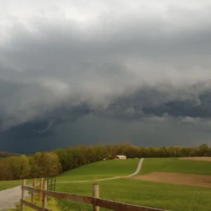 Our active start to severe weather season is likely to continue later this week as a shortwave and associated cold front dive southeast toward the Ohio Valley on Thursday. At this time, it appears that damaging winds and large/very large hail would be the primary threat, but isolated tornadoes may also be possible. Considering the… Read more: Severe Weather Possible Late This Week!!!
- Strong Storm System To Affect The Region On Monday!!!A powerful early spring low pressure system will develop in the Plains and strengthen as it moves into the Great Lakes on Monday. Due to the rapidly strengthening storm and its neutral/negatively tilted trough, there will likely be very strong wind shear ahead of the cold front. While moisture return in the warm sector may… Read more: Strong Storm System To Affect The Region On Monday!!!