

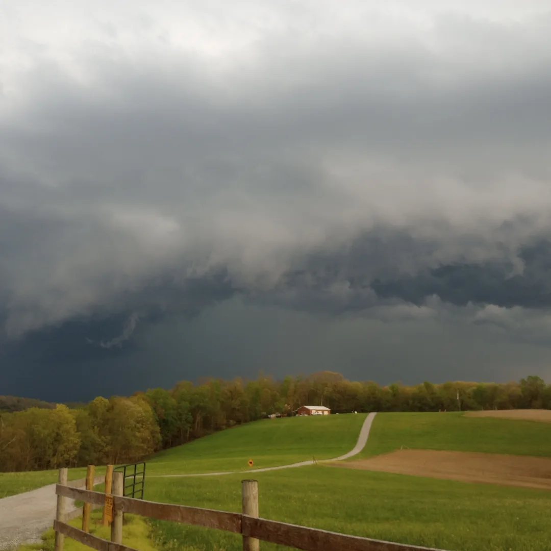
Our active start to severe weather season is likely to continue later this week as a shortwave and associated cold front dive southeast toward the Ohio Valley on Thursday. At this time, it appears that damaging winds and large/very large hail would be the primary threat, but isolated tornadoes may also be possible. Considering the moist low level flow and parallel boundary storm motion, flash flooding may also be a concern.
Some of the key highlights that we will cover in this blog include:
- Meteorological Setup for severe weather
- Expected storm mode and severe weather hazards
- Timing and Areas of greatest risk
While forecasting severe weather days in advance can be challenging, this blog will discuss some possible outcomes.
Meteorological Setup For Severe Weather
An unusually strong early spring ridge of high pressure will continue to bring very warm weather to the central Plains over the next several days. At the same time a shortwave diving southeastward from the Northern Plains will push a cold front toward the Ohio Valley and Central Appalachian region on Thursday. An area of high pressure that is currently situated over the eastern United States will move off the eastern seaboard as we head toward mid-week. Clockwise motion around the retreating high pressure system will help to return Gulf moisture into the region ahead of the approaching cold front. This will set the stage for the potential severe weather episode across our region.
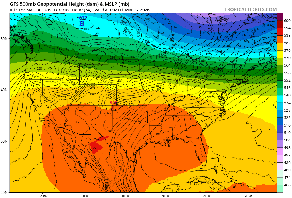
The image above shows the 500 mb pattern on Thursday based on 18z Tuesday GFS model guidance. Image courtesy of Tropical Tidbits.
Ahead of this system, a moist flow will develop, helping to provide the surface moisture needed for severe weather. In addition to the sufficient low level moisture, it is also likely that there will be strong speed shear present. If lapse rates become steep enough to overcome a capping inversion, there is the potential for supercell storms to produce large/very large hail and damaging winds. While the potential is relatively low at this time, it is possible that there could be a couple of tornadoes if there is enough low level moisture and low level directional wind shear available. At this time, it appears that eastern Ohio may be the most favored area for severe weather in our area, but all locations should be prepared for the potential of severe weather late Thursday into Thursday night.
Expected Storm Mode And Severe Weather Hazards
Due to the steep lapse rates aloft and somewhat limited surface-based instability, it is likely that an elevated storm mode will be most dominant. With that being said, it is possible the low level moisture, combined with lower lifted condensational level (LCLs), will be sufficient to support a few surface-based supercells with a tornado potential. Otherwise, adequate speed shear aloft will likely lead to elevated supercells capable of producing downburst winds and large hail. It is possible that very large hail may occur if instability is high enough to support strong updrafts.
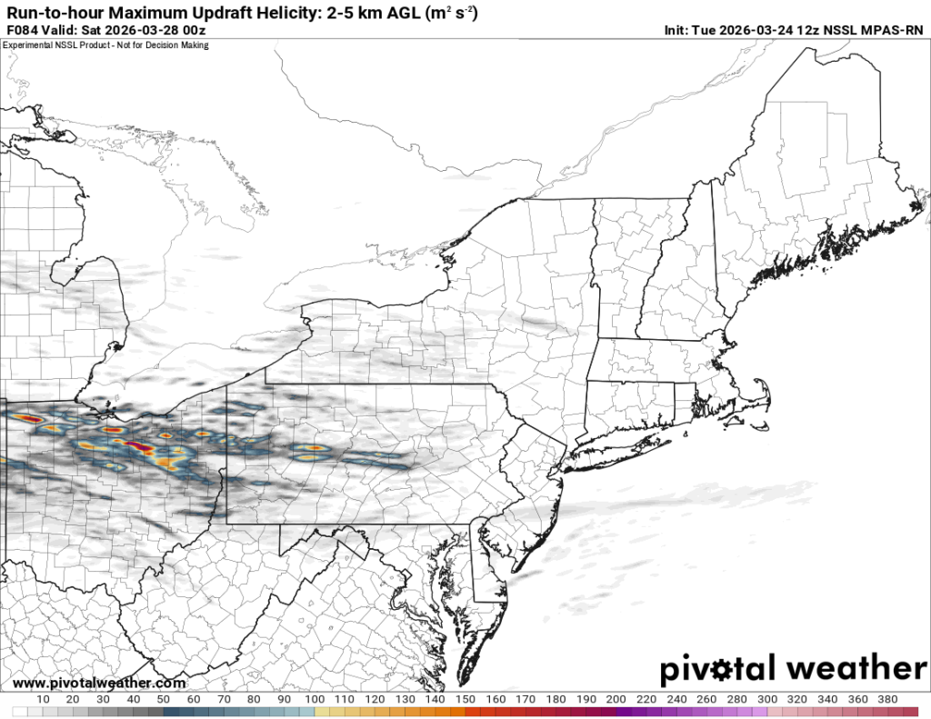
The image above shows a depiction of the 2-5 km updraft helicity for Thursday’s event based on 12z Tuesday NSSL MPAS-RN model guidance. Image courtesy of Pivotal Weather.
If surface winds are too parallel to the boundary, it is possible that the storms may quickly form into a convective line. In addition to the severe weather potential parallel boundary winds may lead to storms training over the same areas multiple times. Given the expectation for elevated dewpoints, it is possible that some instances of flash flooding may occur, especially in areas that experienced heavy rainfall on Sunday.
Timing And Areas of Greatest Risk
At this point in time, model guidance would suggest that Ohio may have the greatest risk for severe weather due to better moisture and more optimal timing of the storms. With this in mind, sufficient ingredients for severe weather may be in place across the entire region and future model guidance should be monitored for potential eastward shifts in the risk area.
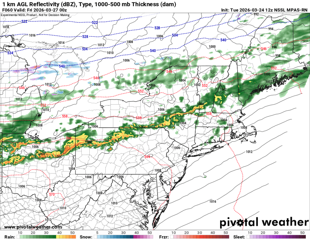
The image above shows a depiction of the surface reflectivity on Thursday evening based on 12z Tuesday NSSL MPAS-RN model guidance. Image courtesy of Pivotal Weather.
The most likely timeframe for severe weather will depend on a couple of factors. The first factor will be dependent on prefrontal supercell initiation and the other will be the eventual speed and progression of the system. While it is too early to forecast the exact timing of storm arrival, it currently appears that storms would arrive across northern Ohio during the late afternoon/evening and progress southeastward toward the rest of the region through the rest of the evening/early overnight hours. As would be expected, a later arrival of the system would likely somewhat decrease the risk of severe weather in our area.
As always, the details regarding the potential for severe weather timing, location, and impacts will become more clear as the event approaches and CAM’s can better sample the atmospheric ingredients.
Leave a Reply