

As we approach the end of winter, many people are looking forward to the return of warmer weather in the coming weeks. While the approach of spring is a welcoming thought following a cold winter, spring time can also bring with it the potential for severe weather episodes that deliver damaging winds, large hail, and tornadoes. While severe weather is complicated, there are four primary ingredients that are necessary for the development of severe weather.
These ingredients include:
- Shear: Wind shear measures the amount of change in wind speed and direction through the atmosphere.
- Lift: The amount of positive buoyancy (or upward motion) available for air parcels to rise and form clouds and precipitation.
- Instability: Instability or convective available potential energy (CAPE) refers to the amount of energy that is available for the atmosphere to produce thunderstorms.
- Moisture: Warm, moist air rises to the lifting condensation level (LCL) where condensation occurs. Strong upward motion can then lead to tall convective thunderstorms that can produce severe weather.
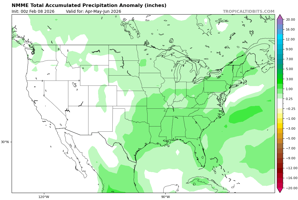
The image above shows a depiction of the precipitation pattern for the spring based on the NNME model guidance. Image courtesy of Tropical Tidbits.
The availability of these ingredients will largely depend on the jet stream pattern that develops across the United States as we approach spring. If the jet stream sets up in a wavy pattern, the number of severe weather opportunities will likely increase as systems bring in the warm, moist air and wind shear needed for severe weather development.
How Does ENSO Affect Severe Weather?
The persistence of an active severe weather pattern into late spring and early summer will likely depend on how quickly El Nino develops in the equatorial Pacific Ocean. A quicker transition to El Nino would favor a decrease in severe weather, while a continuation of El Nino Southern Oscillation (ENSO) neutral conditions could lead to severe weather continuing into the summer.
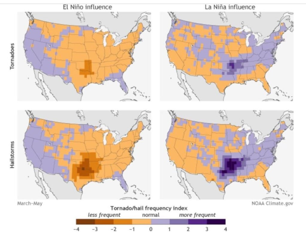
The images above show a depiction of tornado and hail frequency associated with positive and negative ENSO conditions. Image courtesy of National Oceanic and Atmospheric Administration (NOAA).
Through much of the winter season, La Nina conditions have been observed in the equatorial Pacific. With that in mind, La Nina has begun to weaken in recent weeks and is likely to progress to neutral condition this Spring. An eventual transition to EL Nino appears likely during the summer or fall season of 2026.
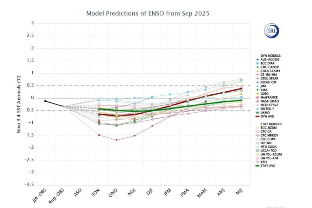
The image above shows the ENSO forecast based on guidance from various long range forecast models. Image courtesy of the National Weather Service.
The Big Picture
While uncertainties exist in any long range forecast, the general consensus favors a fairly active severe weather season with near to above average severe weather observation expected in the area. Now is the time to start thinking about severe weather safety so that you are prepared to protect your family and property during severe weather.
It is important to note that uncertainties still remain in the frequency and intensity of severe weather during the upcoming spring, and this blog may be updated in the future to account for changes to the forecast.
Leave a Reply