


As we enter the upcoming holiday, you are probably interested in how the weather will affect your outdoor picnics and festivities. Here is a look at what is expected at this point in time:
Friday Forecast: Rain Arrives Throughout The Day
Rain will likely overspread the region from south to north throughout the day. Areas south of the PA Turnpike could see rain before noon, while locations north of I-80 may not see rain until the evening hours. Expect high temperatures in the 60s for most locations, with 50s anticipated in the higher elevations from eastern West Virginia to southwest/southcentral Pennsylvania.
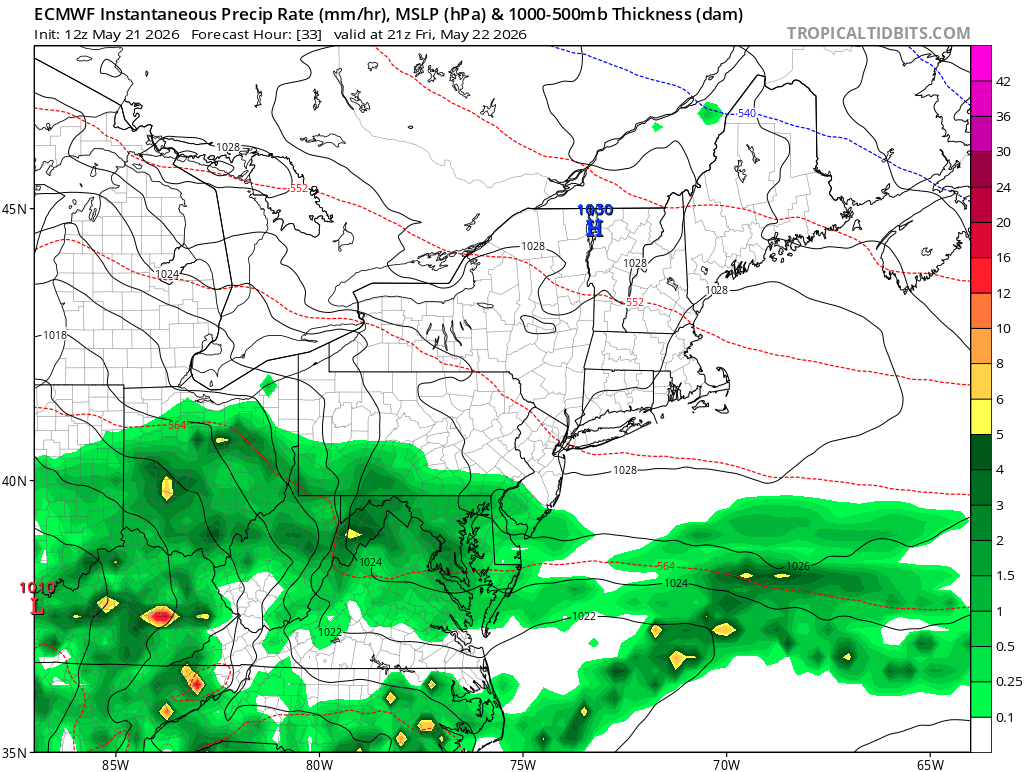
The image above shows a depiction of the surface reflectivity on Friday afternoon based on 12z Thursday ECMWF model guidance. Image courtesy of Tropical Tidbits.
Saturday Forecast: Improvement Likely Throughout The Day
Steady rain is expected to come to an end from southwest to northeast throughout the morning and early afternoon hours; however, scattered showers are likely to persist the remainder of the day. At this point it looks as though the heaviest rainfall totals could occur across Ohio and northwest Pennsylvania, but this could certainty change.
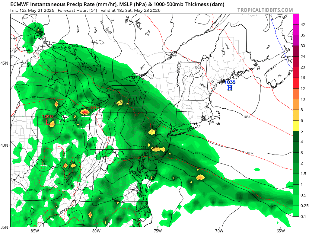
The image above shows a depiction of the surface reflectivity on Saturday afternoon based on 12z Thursday ECMWF model guidance. Image courtesy of Tropical Tidbits.
Heavy rain could also occur with any thunderstorms that can form in Ohio. Expect high temperatures to range from near 70 in Ohio to the rain-cooled 40s in central Pennsylvania.
Sunday Forecast: A Mainly Dry Day For Some. A Chance of Rain For Others
Sunday will likely feature lower rain chances compared to Saturday. Much of eastern Ohio, Maryland, and western/central Pennsylvania will likely see a mainly dry day with the exception of a few showers.
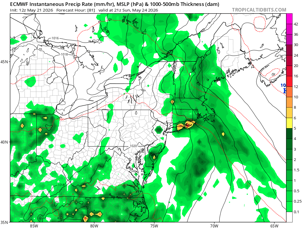
The image above shows a depiction of the surface reflectivity on Sunday afternoon based on 12z Thursday ECMWF model guidance. Image courtesy of Tropical Tidbits.
Areas in West Virginia are more likely to see some showers and possibly a thunderstorm Sunday afternoon/evening. Expect highs to range from the 70s across Ohio, western Pennsylvania, Maryland, and West Virginia to the 60s across most of central Pennsylvania.
Memorial Day Forecast: Mainly Dry For Most. An Isolated Shower or Storm Possible
Memorial Day: Monday appears to be a mainly dry day for many locations in our region. A pop-up shower or storm may occur in a few locations, but most locations should see mainly dry conditions throughout the day. At this point, it appears that southern areas would have the best chance of seeing wet weather. Expect high temperatures in the 70s in most areas.
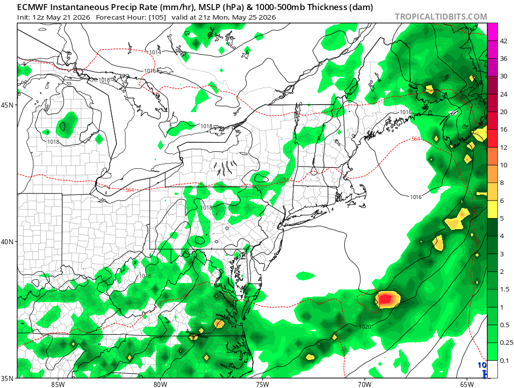
The image shown above shows a depiction of the surface reflectivity on Monday afternoon based on 12z Thursday ECMWF model guidance. Image courtesy of Tropical Tidbits.
Expected Rainfall Totals Through Memorial Day
While all areas of our region will see rainfall through Memorial Day, some locations will likely see more than others. The determining factor for which regions see the highest rainfall totals will be the location of a high pressure system over New England and a surface area of low pressure tracking through the Ohio Valley.
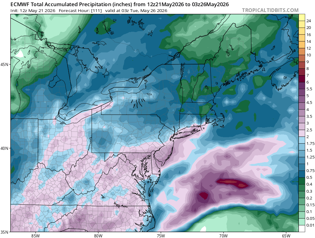
The image above shows a depiction of expected total precipitation through late Monday night based on 12z Thursday ECMWF guidance. Image courtesy of Tropical Tidbits.
At this point, it appears that Ohio, West Virginia, Maryland, and southcentral Pennsylvania may see the highest amounts with totals of 1.5 to 2.5 inches, while western and northern Pennsylvania may see totals closer to the 1-1.5 inch range.
While this summary gives a general idea of what is currently expected, keep in mind that this forecast will likely change over the next couple of days.
Refer to the following resources for additional information:
Leave a Reply