

While most of the region did not experience a white Chirtsmas, the same will not be said for New Year’s Day. Accumulating snow is expected for most areas across the region from Wednesday afternoon through Wednesday night as a winter storm moves into the region.
Some of the major impacts from the upcoming winter storm include:
- Light Snow Accumulation Possible With A Weak Disturbance Tonight.
- Plowable Snow Expected For Areas Along And West of The Allegheny Front on New Year’s Eve
- Snow Squalls Likely Across Much of The Region Late Wednesday.
Light Snow Accumulation Possible WIth A Weak DIsturbance Tonight
Prior to the more substantial snow event expected Wednesday into Wednesday night, a weak weather disturbance will move southeast toward the region tonight bringing a quick chance for light accumulating snow for areas along and west of the Allegheny Front. A general coating to two inches is expected for most locations.
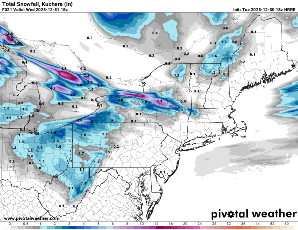
The image above shows the expected snow totals through 10 a.m. Wednesday, based on the HRRR model. Image courtesy of Pivotal Weather.
Plowable Snow Expected For Areas Along And West of The Allegheny Front New Year’s Eve
As we head into the day on New Year’s Eve, a storm system will begin to approach the region from the northwest. During the afternoon, snow will begin to fall across the area. The snow will start first in northern and western parts of the region, and spread southeast through the afternoon. Snowfall of varying intensity will continue for most locations through the evening and begin to taper off from northwest to southeast through the overnight hours.
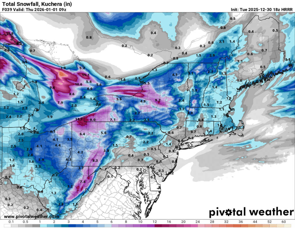
This map shows a depiction of expected snowfall totals based on the HRRR model. Image courtesy of Pivotal Weather.
Snowfall accumulations are expected to range from three to five inches for most locations in eastern Ohio, western Pennsylvania, and western Maryland from Tuesday afternoon through Thursday morning. Higher elevations near the spine of the Appalachians are likely to see snowfall totals in the six to eight inch range, with localized amounts approaching a foot in isolated areas. The typical snowbelt areas form northeast Ohio to southwest New York will likely see a general 12 to 18 inches.
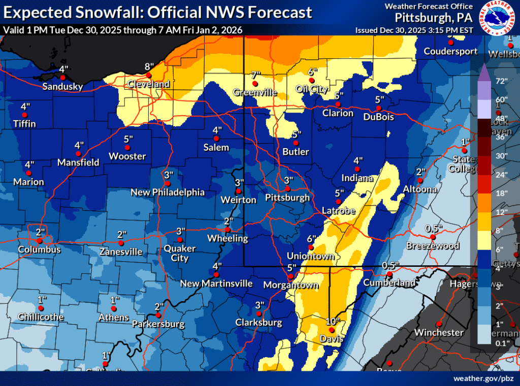
The image above shows the expected snowfall accumulations across the region form Tuesday afternoon through Friday morning. Image courtesy of NWS Pittsburgh.
Snow Squalls Likely Across Much of The Region Late Wednesday
While snow will be ongoing for many areas by the afternoon hours on Wednesday, a line of snow squalls will likely impact the region as well. These squalls will likely spread from across the areas from northwest to southeast through the evening hours. As the squalls move through, there will be a potential for heavy snowfall rates, reduced visibility, and dangerous driving conditions.
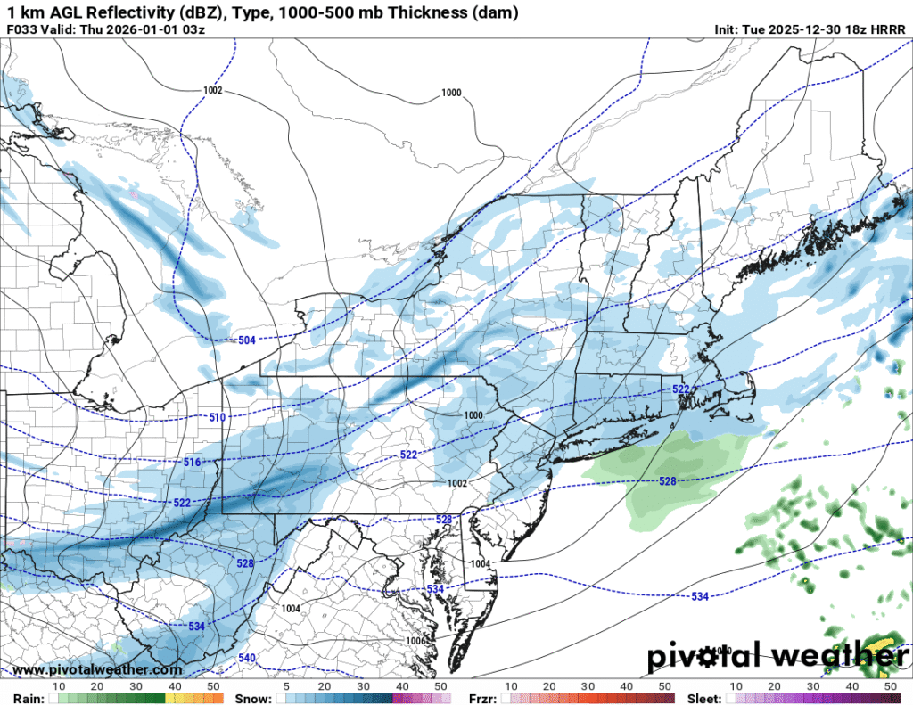
The image above shows snow squall potential across the region Wednesday evening, based on the HRRR model. Image courtesy of Pivotal Weather.
While the more substantial snow accumulations are expected along and west of the Allegheny Front during the upcoming event, the advancing snow squalls are likely to bring a quick light snow accumulation to areas east of the Allegheny Front as well. As these snow squalls move across the region, travel will likely become difficult or impossible as heavy snow and gusty winds severely reduce visibility.
Additional resources for additional information:
Leave a Reply