

The first widespread winter storm of the season will impact the Central Appalachian region Monday night into Tuesday morning bringing widespread accumulating snow to much of the region. There is also a low end potential for wintry mix or freezing rain in some areas as well.
Here are the main takeaways
- Widespread accumulating snow is likely
- Some chance for mixed precipitation in the pa PA and Wv ridges
- Swath of 3-5” of snow is likely where the heaviest band of snow sets up
Snow will begin to move into the region around midnight tonight, spreading from west to east. The snow will likely come down heavy for a time around the Tuesday morning commute. The combination of cold surface temperatures and heavy snow will cause roadways to become snow-covered and slippery. Snow will begin to taper off from west to east throughout the morning and most meaningful snow accumulation should end by noon.
Will There Be Any Mixed Precipitation or Rain?
While the chance for accumulating across much of the area is high, there is a chance that enough warm air could get pulled into the system to cause some areas to see rain or a freezing rain for a period Tuesday morning. With that being said, uncertainty in this scenario is fairly high, and it is entirely possible that most areas see mainly snow.
Let’s take a moment to look at some high resolution model guidance and analyze some of the differences they present for a possible outcome.
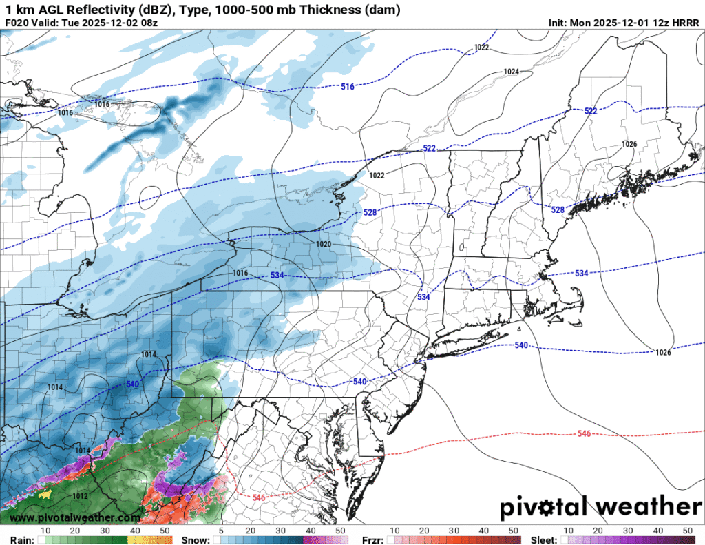
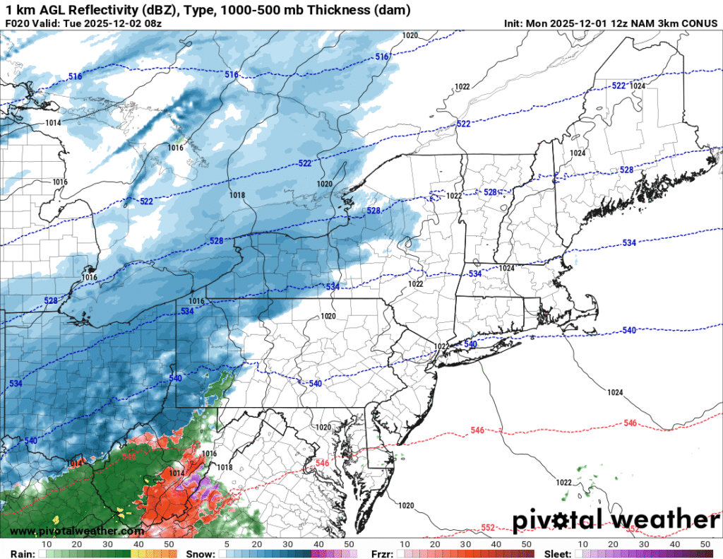
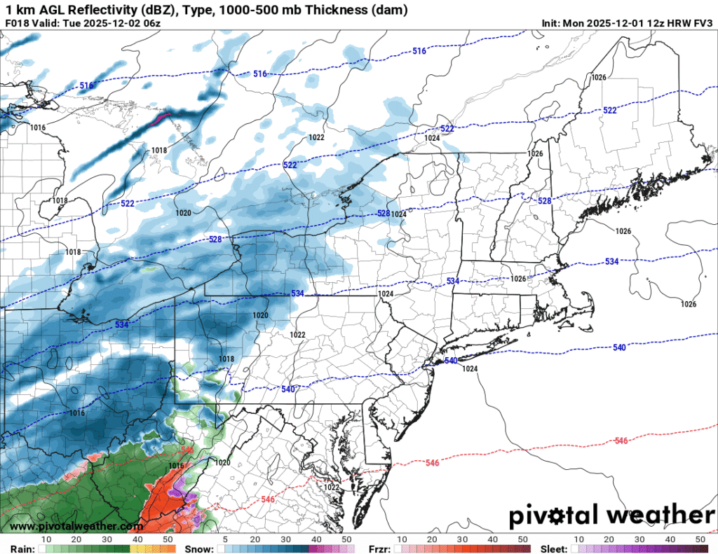
The images above show a depiction of the precipitation type as the system approached the area Tuesday morning. Images courtesy of Pivotal Weather.
For southwestern PA, it appears that the best chance for precipitation types other than snow would be at the onset of precipitation.Thermal profiles would suggest that the temperatures will quickly fall to at or below freezing at all levels. This will likely cause a quick transition to snow for most of southwestern PA.
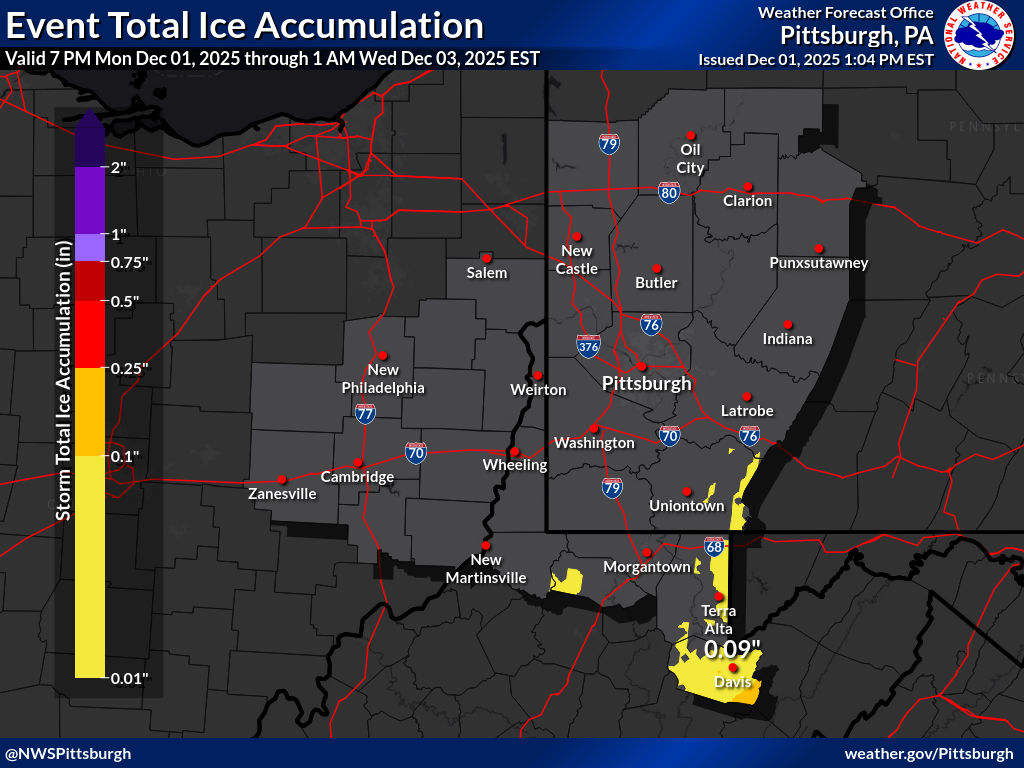
This image highlights the potential for freezing rain in the PA and West Virginia high terrain. Image courtesy of NWS Pittsburgh.
Further south into West Virginia, an extended period of freezing rain appears possible, which would reduce snow totals in this area. For areas in West Virginia outside of the high terrain, an extended period of rain will cut down on snow accumulations.
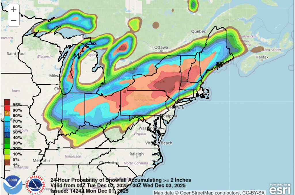
This image shows the probability of at least two inches of snow across the region during the upcoming winter storm. Image courtesy of the Weather Prediction Center.
The main message is that the first widespread accumulating snowfall of the season is likely across the region, and the system will be disruptive to travel during the Tuesday morning commute.
Additional resources for additional information:
Leave a Reply