

There is increasing confidence that there will be some accumulating snow across parts of the Central Appalachian region early next week. Over the past couple of days, model guidance has begun to diverge on a solution that indicates a low pressure system that will develop over the Southeastern United States and track northeast toward the Mid-Atlantic coast.
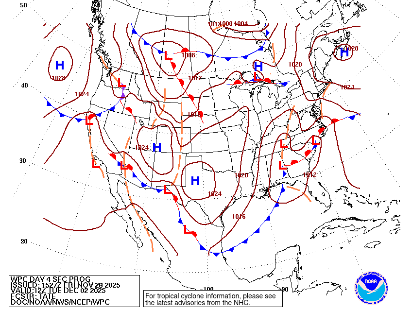
This image shows a view of low pressure that is expected to be located over the southeastern United States early next week. Image courtesy of the Weather Prediction Center.
With an intrusion of Arctic air moving into the region Sunday night into Monday, there will be ample cold air to produce accumulating snow on the northwest side of the low pressure system. It is important to note that the system is still 3-4 days out, and the specific details regarding timing, location, and snow accumulation are uncertain at this time.
Here are some aspects of the forecast that are more certain:
- A winter storm will likely affect at least parts of the region between Monday night-Tuesday night.
- At least some snow accumulation is likely.
- The chance of travel impacts is relatively high.
Here are some aspects of the forecast that are more uncertain at this time:
- The exact strength and track of the storm is still a bit uncertain
- The amount of moisture that will overlap with the cold air.
- Snowfall totals in any specific location.
- The location of the rain/snow line.
- Ice accretion from freezing rain.
What Is The Most Likely Outcome Based On Current Forecast Model Projections?
While there are some differences in the models forecast models, the overall consensus indicates that there will be a favorable storm track for accumulating snow for portions of the Ohio Valley, Central Appalachians, Mid-Atlantic, and Northeast.
With that being said, let’s take a moment to look at some of the models to see where they agree and disagree regarding next week’s system.
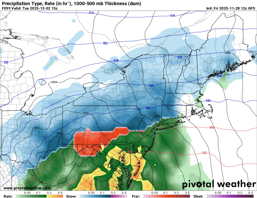
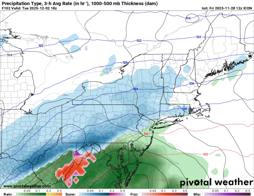
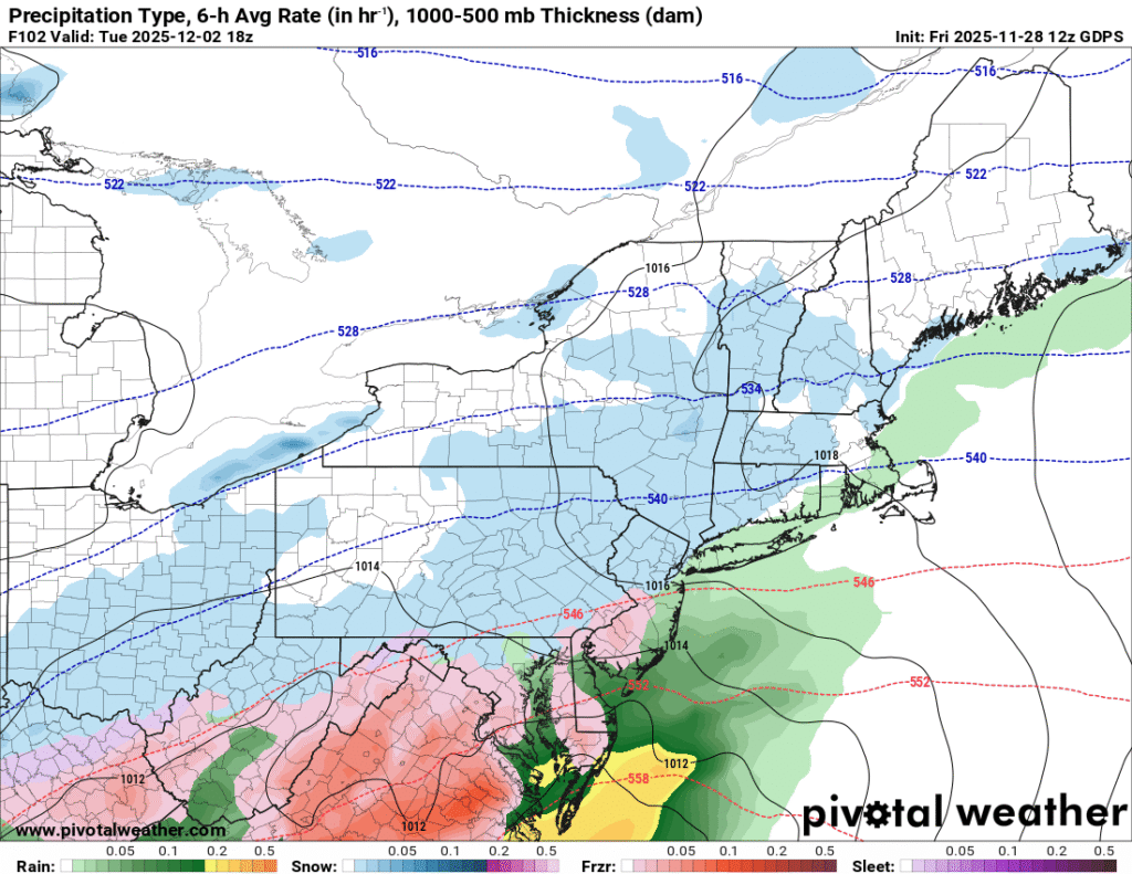
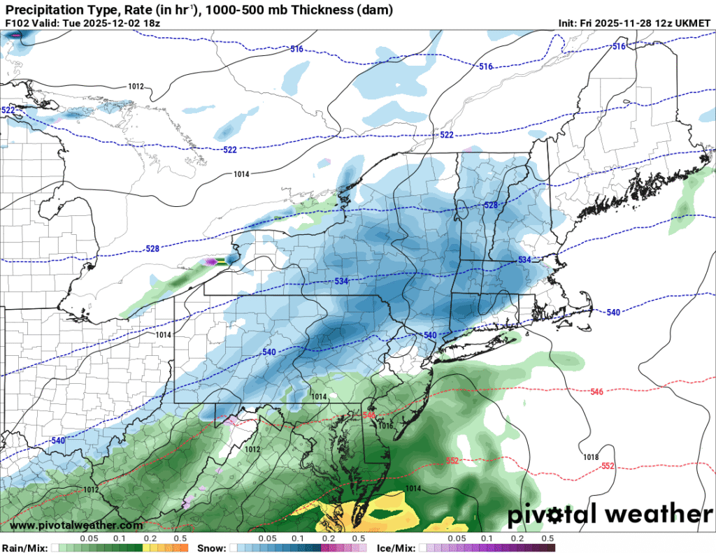
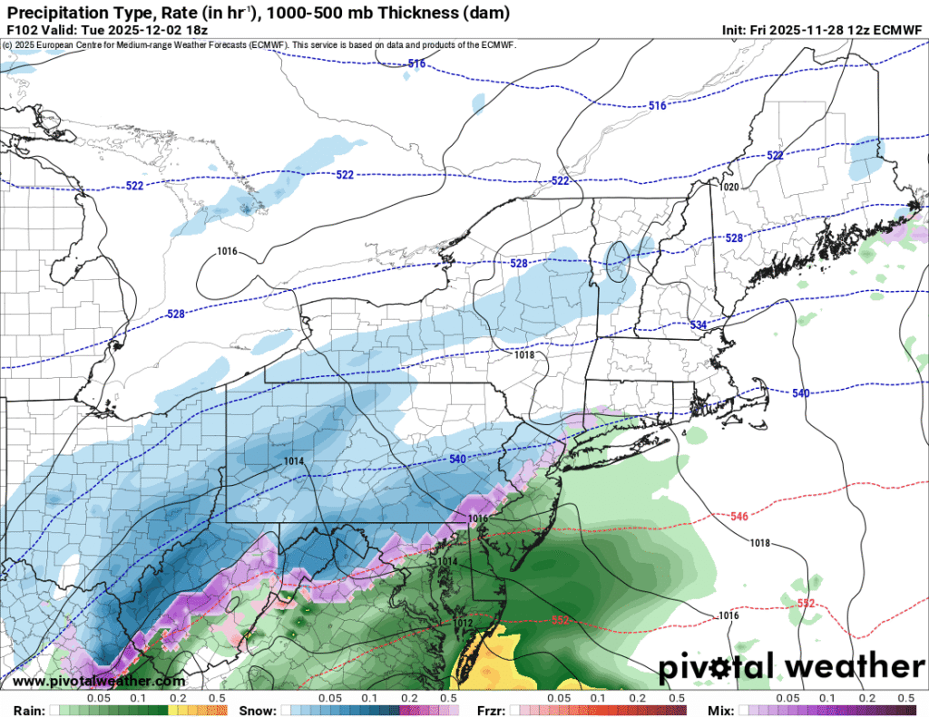
These images show a depiction of precipitation type and intensity for Tuesday based on 12z guidance from the GFS, ICON, Canadian, UKMET, and European forecast models. Image courtesy of Pivotal Weather.
As you can see, there are still uncertainties regarding the timing, intensity, and track of the low pressure system. There are also uncertainties regarding the location of the rain/snow line, and any mixed frozen precipitation risks that may occur near this line. The big picture is that impactful winter weather is likely early next week, and differences in the models will work themselves out over the next few days.
Additional resources for additional information:
Leave a Reply