
While it has been a mild start to Thanksgiving week, that will certainly change as we approach Thanksgiving Day. Many areas across the Central Appalachia region are currently experiencing wet and relatively mild conditions as a storm system slides through the area.
Here is a breakdown of what to expect through the remainder of the week
- Scattered showers and increasingly windy conditions as a strong cold front approaches from the west on Wednesday.
- Scattered snow showers, well below average temperatures, and windy conditions for Thanksgiving Day.
- Significant lake effect snow accumulation from northeast Ohio to western New York from Wednesday night through Friday.
- A storm system will bring the likelihood of moderating temperatures and the risk for rain and snow over the weekend.
What is the Forecast for Pre-Thanksgiving Travel?
As previously mentioned, Wednesday will feature the approach of a strong cold font that will cause a transition to much colder weather at midweek.
Here are a few things to keep in mind:
- Showers will become more numerous from west to east as the day progresses.
- Much colder air will arrive Wednesday night, with the potential for some snow showers along and west of the Allegheny Front.
- Lake effect may begin to impact parts of the primarily snowbelts from northeast Ohio to western New York.
What Is The Weather Forecast For Thanksgiving Day?
Some important things that you should be aware of regarding the Thanksgiving forecast include:
- Well below average temperatures across the entire region.
- Gusty winds will accompany the winter-like chill.
- Lake effect snow will affect the primary snowbelt areas.
- Scattered snow showers are possible along and west of the Allegheny Front.
Thanksgiving Day will likely feel more like the middle of winter than late fall across the Central Appalachia region.
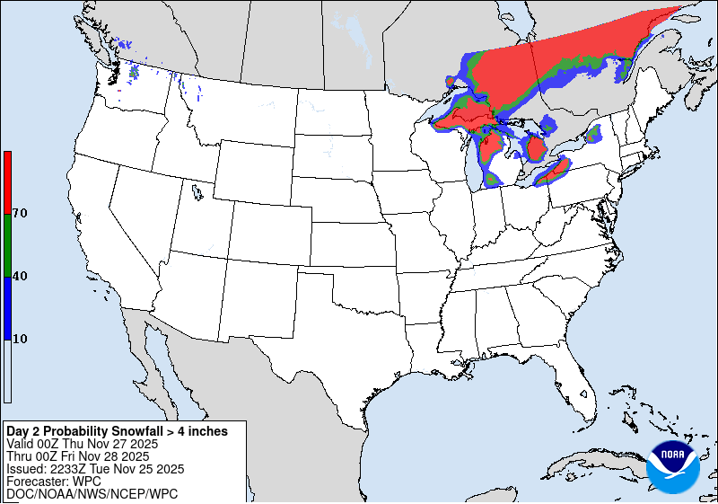
This image highlights the increased likelihood of impactful lake snow on Thanksgiving Day downwind of Lake Erie. Image courtesy of Weather Prediction Center.
While it will be cold for all areas of the region, those living downwind of Lake Ontario and Lake Erie will experience impactful lake effect snow at times throughout the day. The Weather Prediction is indicating that there is at least a 70 percent chance of 4 inches of snow or more for these areas on Thanksgiving Day.
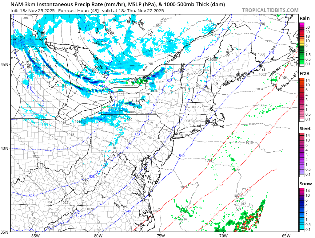
This image shows a depiction of expected lake effect snow on Thanksgiving Day. Image courtesy of Tropical Tidbits.
It is important to note that this is just one model depiction and the location of lake effect snow bands can vary based on the direction of the wind. The main message is that those traveling toward the primary snowbelts on Thanksgiving Day should be prepared for rapidly changing weather conditions.
What Will The Weather Be Like For Black Friday And Post-Holiday Travel?
For much of the region, Black Friday will feature a continuation of the cold and windy conditions. Lake effect snow will likely be ongoing in the typical lake effect regions previously mentioned.
This image shows a visual of the continued lake effect activity downwind of the lakes on Black Friday. Image courtesy of Tropical Tidbits.
As we head into the day on Saturday, the weather will likely start off cold and dry across the region.
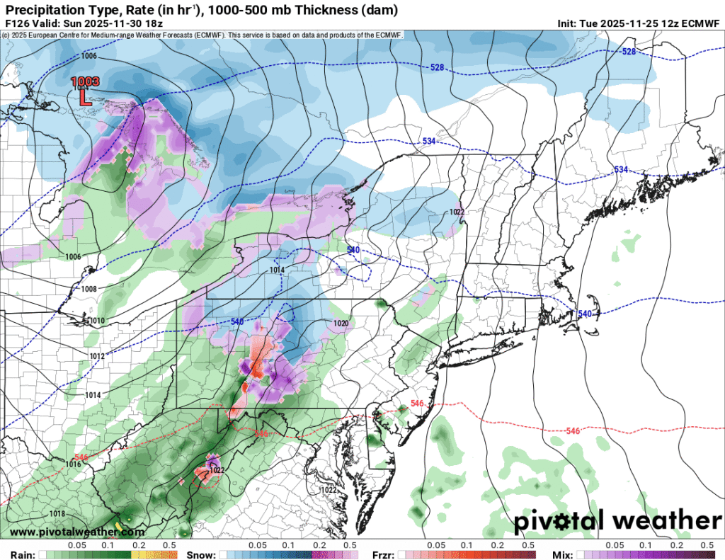
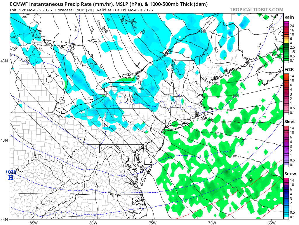
This image indicates the potential for mixed precipitation on Sunday. Image courtesy of Pivotal Weather.
As we close out the weekend on Sunday, a storm system over the Plains will likely move toward the region providing the opportunity for precipitation chances. The precipitation type will depend on how much cold is still in place across the region.
Additional resources for additional information: