

A powerful early spring low pressure system will develop in the Plains and strengthen as it moves into the Great Lakes on Monday.
Due to the rapidly strengthening storm and its neutral/negatively tilted trough, there will likely be very strong wind shear ahead of the cold front. While moisture return in the warm sector may be limited, it is possible that the strong kinematics may be sufficient to produce severe weather across parts of the region Monday afternoon.
Some topics that we will discuss in this blog include:
- Meteorological Analysis of The Storm System
- Potential Impacts From The Storm Across Our Area
- Timing of the Front Is Important
Now let’s dive into our discussion about the upcoming powerful storm system!
Meteorological Analysis of The Storm System
As we head into Sunday, a strong storm system will begin to develop across the central United States. As the storm begins to move northeast toward the Great Lakes, it is expected to intensify into a strong mid-latitude cyclone by Monday. The storm system will also begin to transition from a neutral to a negatively 500mb trough as this process occurs.
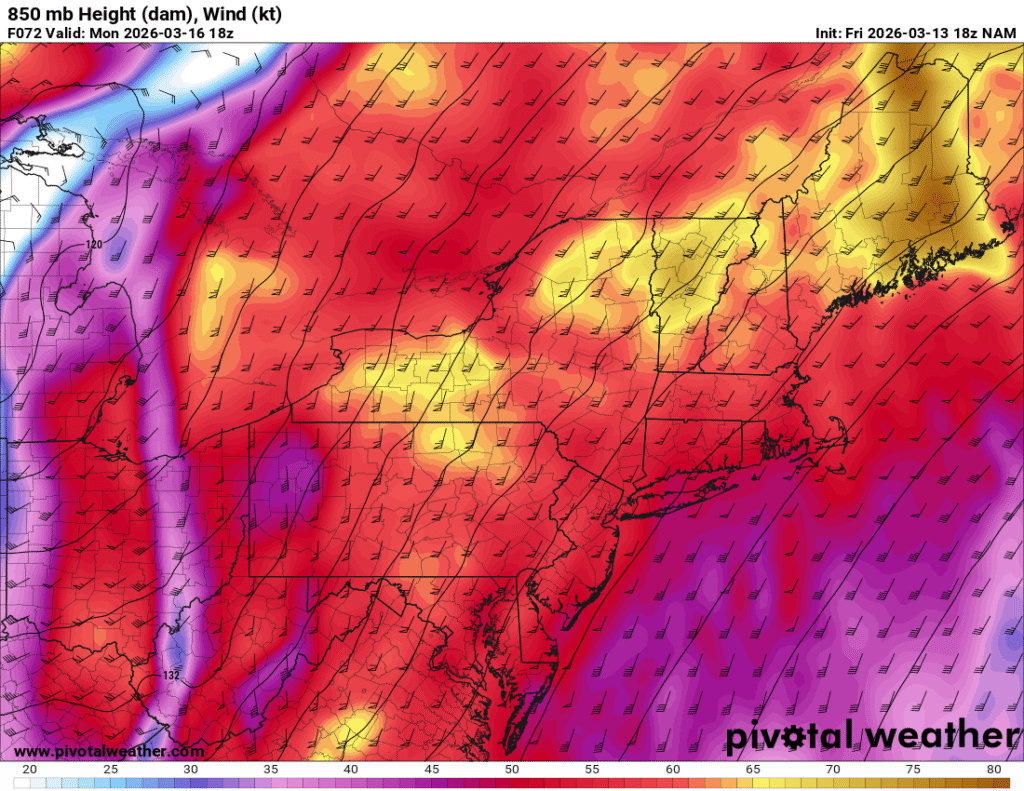
The image above shows a depiction of the 850 mb jet winds across the area early Monday afternoon based on 18z NAM 12 km model guidance. Image courtesy of Pivotal Weather.
This will result in a strong low level 850 mb jet streak that will develop across the Mississippi Valley on Sunday and move across the Ohio Valley, Mid-Atlantic and Northeast on Monday, leading to impactful and potentially damaging weather conditions across a wide swath of the central and eastern United States.
Potential Impacts From The Storm Across Our Area
Due to the rapidly strengthening storm and its neutral/negatively tilted trough, there will likely be very strong wind shear ahead of the cold front. While moisture return in the warm sector may be limited, it is possible that the strong kinematics may be sufficient to produce severe weather across parts of the region Monday afternoon.
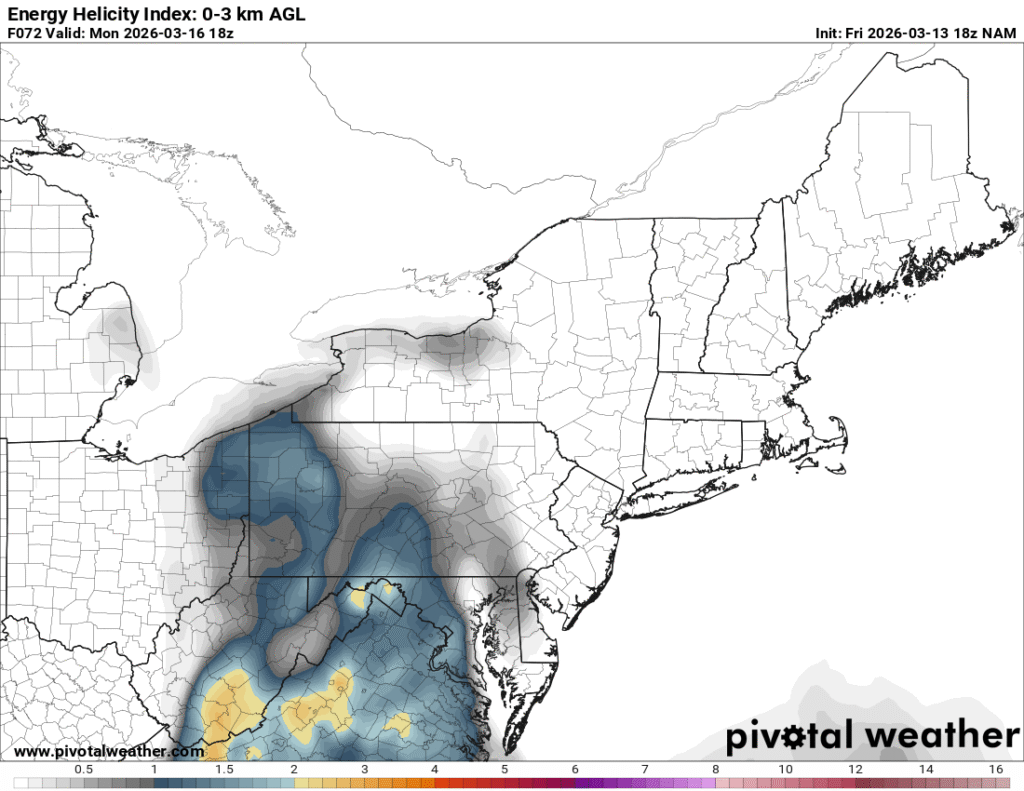
The image above shows a depiction of the Energy Helicity Index (EHI) across the region early Monday afternoon based on 18z NAM 12km guidance. Image courtesy of Pivotal Weather.
While it is too early to analyze many of the convective allowing, high revolution model guidance, the pattern appears favorable for the potential for impactful damaging winds and potentially embedded tornadoes along the cold front. When analyzing the 18z NAM 12 km guidance, we can see that there is a decent Energy Helicity Index (EHI) across our region Monday afternoon. This parameter helps to determine where the best overlap of instability and wind shear are located. The severe weather potential will likely be most prevalent in the area where the EHI is at its maximum. If sufficient moisture returns ahead of the front occurs, it is possible that a few discrete supercellular storms could develop as well. At this time, this idea appears unlikely across most of our area.
Timing of The Front Is Important
The timing of the front will be important. If the system is slower to arrive, the potential for severe weather would increase across many areas. A frontal passage that occurs during the morning hours would not allow for much surface heating and destabilization to occur prior to the passage of the cold front; whereas, an afternoon frontal passage would allow for a heightened severe weather potential, resulting from stronger updrafts. Even if the timing of the front is not favorable for severe weather, it is possible that a line of strong to damaging winds will still occur, given the strong low level jet that will be moving through the region.
It is important to emphasize that the potential impacts from this storm system are still two to three days away, and changes to the forecast will certainly occur over the next couple of days.


